

United States Department of Commerce NOAA / National Weather Service
U.S. Tsunami Warning System
NOAA / National Weather ServiceU.S. Tsunami Warning System

- Products/Messages
- Tsunami Data
- Education/Outreach
- Exercises
- NOAA Tsunami Program
- TsunamiReady
- International Tsunami Information Center (ITIC)
- ITIC Caribbean Office
- Tsunami Research
- National Tsunami Hazard Mitigation Program
- UNESCO-IOC Tsunami Programme
- Tsunami Warning Centers
- Follow Us!
 Twitter
 Facebook
 YouTube
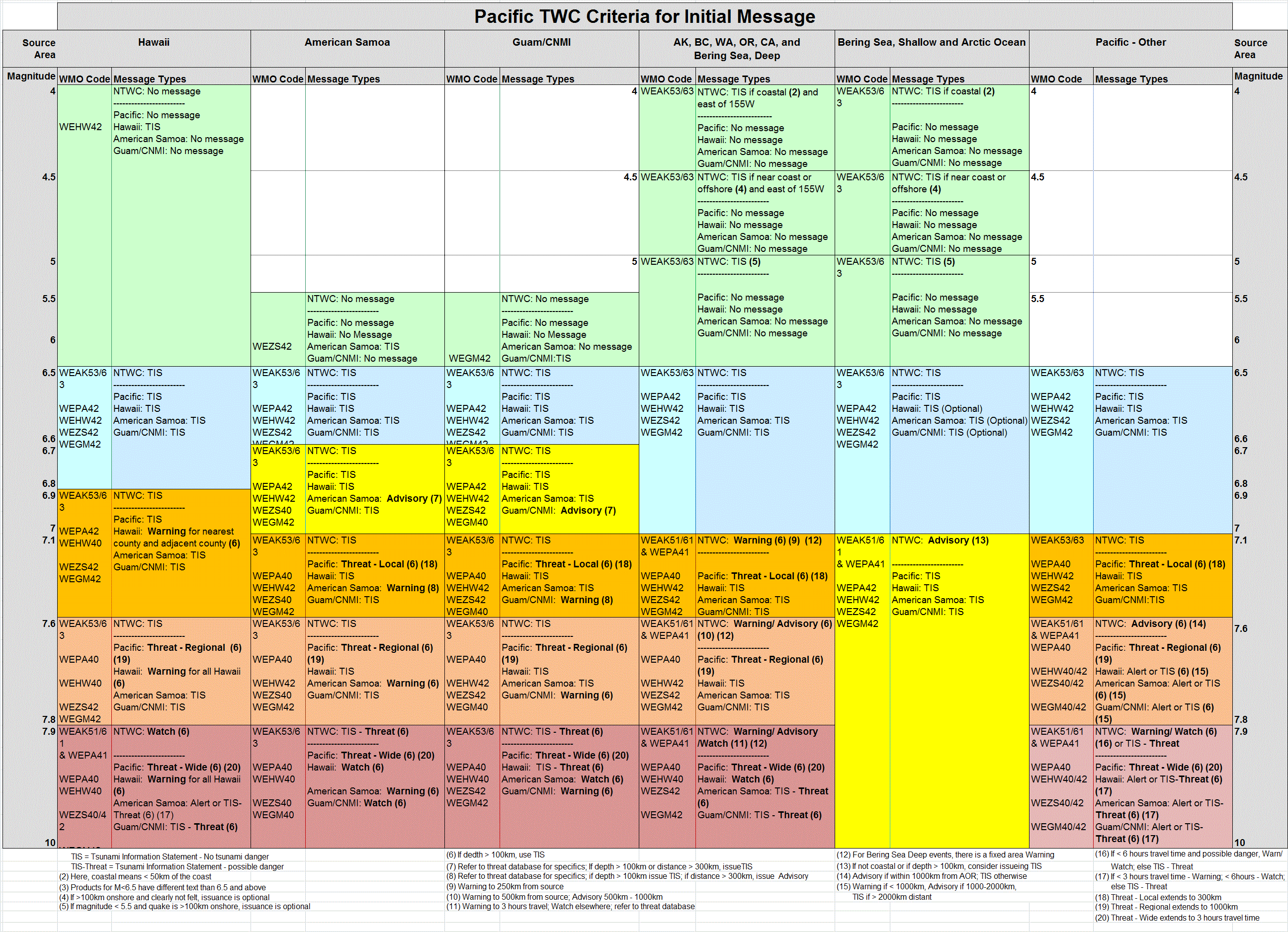
National Tsunami Warning Center, NOAA/NWS
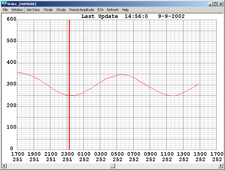
TSUNAMI of 8 September 2002
A major earthquake with a surface wave magnitude of 7.7 occurred at 1844 UTC 8 September 2002
and was located near the North coast of New Guinea, PNG (3.3S 143.1E).
The earthquake produced a tsunami that was recorded at the following sites:
1. Manus, PNG Tide Gauge"
(operated by the National Tidal Facility of the Flinders University of South Australia). The maximum peak-to-trough wave height can be seen from the graphic to be approximately 13 cm
2. Wake Island Tide Gauge
(operated by Pacific Tsunami Warning Center). The maximum peak-to-trough wave height can be seen from the graphic to be approximately 5 cm
3. According to K. Abe of the Earthquake Research Institute in Tokyo, Japan, 17 tide stations in Japan recorded the tsunami. A maximum amplitude of 20 cm was recorded at Naze, Amami-oshima Island, Japan.
The amplitudes ranged from 0.2m to 0.02m with an average amplitude of 0.08m (+/-0.04m) for the 17 stations.
1. A collection of news releases and other media reports on the earthquake compiled by Lori Dengler, Dept of Geology, Humbolt State College, Arcata, CA.
2. Sound bite (2.6Mb) from Australian radio on the day of the tsunami.
Return To:
Back to NTWC Home Page
Proudly brought to you by NOAA - National Weather Service