

United States Department of Commerce NOAA / National Weather Service
U.S. Tsunami Warning System
NOAA / National Weather ServiceU.S. Tsunami Warning System

- Products/Messages
- Tsunami Data
- Education/Outreach
- Exercises
- NOAA Tsunami Program
- TsunamiReady
- International Tsunami Information Center (ITIC)
- ITIC Caribbean Office
- Tsunami Research
- National Tsunami Hazard Mitigation Program
- UNESCO-IOC Tsunami Programme
- Tsunami Warning Centers
- Follow Us!
 Twitter
 Facebook
 YouTube
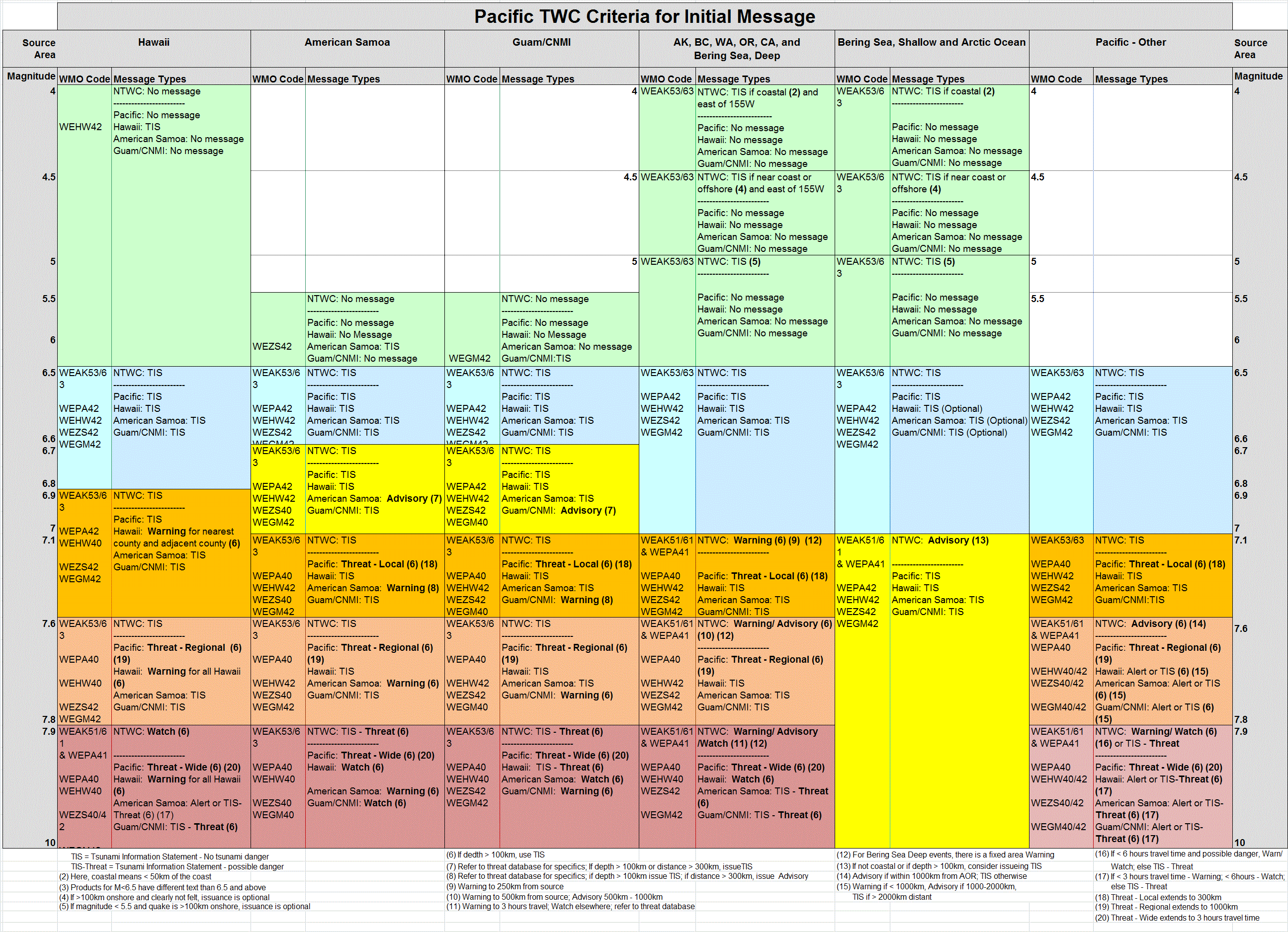
National Tsunami Warning Center, NOAA/NWS
Tsunami of 5 September 2004
A major earthquake with a moment magnitude of 7.4 occurred at 1457 UTC 5
September 2004 and was located near the South coast of Honshu, Japan (33.184°N, 137.071°E,
10km depth - USGS location).
The earthquake produced a small tsunami that was
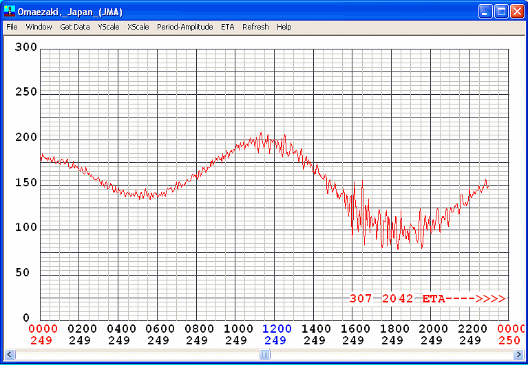
recorded at several tide gages operated by the Japanese Meteorological Agency. Click on the site
name to see a graph of the tsunami. Wave heights are maximum peak-to-trough height in cm. Arrival
time is the actual tsunami arrival time in UTC on gages where it could be determined.
The ETA is the estimated time of arrival computed at the National
Tsunami Warning Center (NTWC) based on the origin time and location. The
Sample Interval column shows the time between samples. Click on the Data File column to get the
raw data for JMA tide gages which have a 2 minute real-time output
to the NTWC. Data can be saved using text mode with your browser. Water level
values are given in m. The first sample in the file is the first sample of the
day.
For additional information about this tsunami see Pacific Tsunami Warning Center Web Page
.
| Tide gage site | Wave height (cm p-t) | Arrival time (UTC) | ETA (UTC) | Initial motion | Sample Interval (min) | Data File |
| Omaezaki, Japan | 71 | 1600 9/05 | 1520 9/05 | fall | 2 | Data (m) starting at 0000 UTC 9-05-04 |
Return To:NTWC Home
Proudly brought to you by NOAA - National Weather Service